
Disclaimer, this is one of the few blog entries where I will keep certain routes and names of landmarks a secret. I’m doing this mostly to protect those areas from becoming trashed and overcrowded due to the advent of social media. The waterfall and some of the routes are left unnamed in order to help safe guard them, if you would like to find them for yourself feel free to leave your email in the comments below and I can point you in the right direction.
Three summers ago, I was on the verge of jumping from a small light dual sport motorcycle to a larger dual sport motorcycle that would be better suited for highway travel yet still be capable off road. While I loved my 2007 Yamaha XT225 it did have its limitations and I was heading in a different direction. Before I decided to sell it, I wanted to take it on one last trip into the Wet Mountains of Southern Colorado to hunt down an elusive waterfall. What makes this waterfall so elusive you might ask, well I had tried to search for it a few times and before I knew it, I got sidetracked by some great single track and two track riding on trails known as Ciseneros, Snowslide, Squirrel Creek, and the infamous St. Charles. I highly recommend looking up some videos showcasing the St. Charles Trail and the massive amount of switch backs and steep drop off’s that the trail is known for.

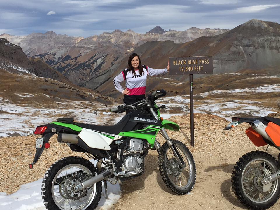
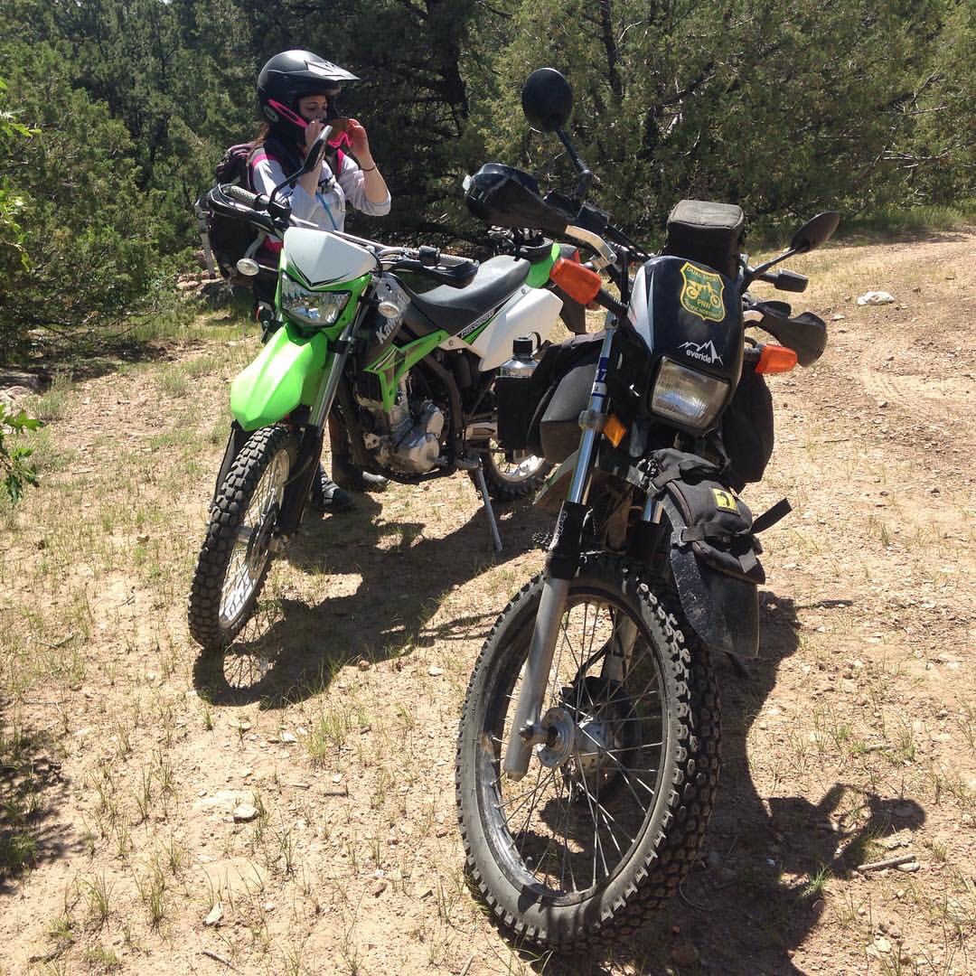
This time things were going to be different as I was armed with my usual National Forest Motor Vehicle Usage Map (MVUM), a Colorado Back Country Discovery Guide that had information about the Wet Mountains and the waterfall, and a Garmin Forerunner GPS. Instead of riding into the Wet Mountains by myself as I usually did, I decided to take one of my best friends with me, Jody. Jody and the word “normal” don’t often collide in the same sentence. While most girls in their mid-20’s are starting families and becoming established in their careers Jody was riding her Kawasaki KLX250S down Black Bear Pass in the San Juan Mountains and on single track trails in the Rampart Range area outside of Colorado Springs. Jody’s grit, determination, and adventurous spirit were the final piece of the puzzle for this trip.
We started our excursion in Pueblo, Colorado and fought our way through light city traffic before we began the long trek down the arrow straight Colorado State Highway 78. For twenty miles our little bikes slugged it out at 55 miles an hour as we headed toward the sleepy mountain town of Beulah. Our time getting to Beulah seemed like it took forever however once we got there that’s when the fun began. Outside of Beulah we jumped on a series of forest roads in the San Isabel National Forest and quickly climbed to an unnamed pass at around 9,000 feet. Once we came down the other side, we took a short hop up Colorado State Highway 165 and headed towards the San Isabel National Forest’s Davenport campground. From here we began our single-track run by taking the Mace Trail further into the San Isabel National Forest and then took a cut off towards Bishop’s Castle.

This area was where things started to get tricky since Jody’s bike was running tires that weren’t well suited to the decomposed granite dust that covered most of the inclines in the area. After fighting our way through a few steep inclines, we finally came out right across from Bishop’s Castle.
From Bishop’s Castle we made our way to the Ophir Creek Road which leads all the way up to an intersection of forest roads, single track trails, and two track trails. This general area is unofficially known as the “four corners” and can be tricky to navigate since some of the trail systems are marked very poorly or not at all.
From Ophir Creek Road we decended towards the small town of Gardiner and took a series of ranch roads that led us back into the San Isabel National Forest. From here we followed a series of fire break roads and a short two track trail that finally took us to our hidden waterfall. To get to this point wasn’t terribly difficult as long as you followed the MVUM from the National Forest Service.

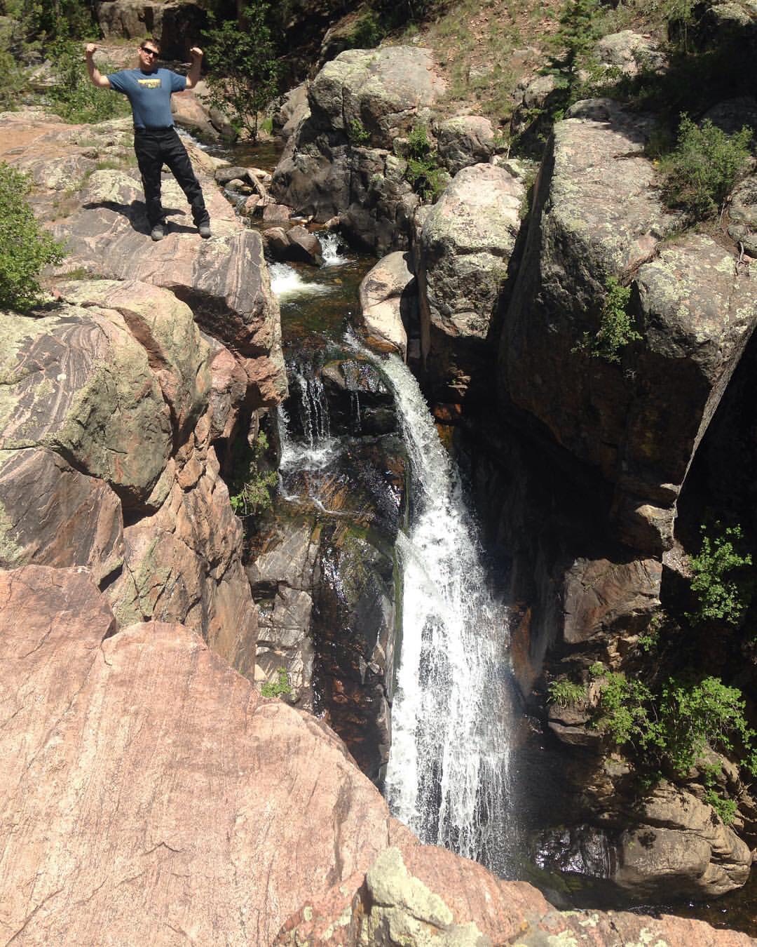
The waterfall itself was fed by a stream that came running off Greenhorn Mountain, which is the highest point in Pueblo County at 12,352 feet. Since we did this trip in late June there was still quite a bit of snowmelt running off the mountain which gave the water fall a decent flow rate. Overall, the falls were more then I imagined even after seeing pictures of it and reading about it in online forums and in books. With a height of about 25 feet and at the beginning of a narrow canyon it’s a very impressive terrain feature.
Our trip back home was fairly uneventful and we were exhausted due to wrestling our bikes along the single-track segments as well as the scorching June heat of Southern Colorado. Looking back, I think our only issue was when Jody’s bike was very low on gas coming back into Beulah since her KLX250S had a much smaller tank capacity (2.3 gallons) then my XT (4.1 gallons with a Clarke tank). At the end of the day we rode almost 200 miles and spent over 120 miles off road and got to enjoy some of the most underrated scenery in the state while chasing an elusive waterfall.

Dana, will you point me in the direction of the waterfall (assuming it is accessible on a R1200 GS)? I’m out in southern CO for a week of riding and dispersed camping and this sounds like a cool spot to find. I read your recent post on the Wet Mountains also, but if you have any additional advice on good out of the way spots to camp and do day rides from in the area that would be awesome. V/R, Nate
LikeLike
Nate, I think I can help you out please email me at strykeradv@gmail.com and I can send you some ideas.
LikeLike